Cayo Levantado, Dominican Republic
Bahia Principe, Cayo Levantado, Samaná Province, Dominican Repuplic.
Coordinates in degrees decimal: N 19.166397, E -69.277031.
Visited in November 2018. Photographer: Nigel Thomas. Cameras: Olympus Tough T5, Pentax WG-II and Sea & Sea 1G with DX1G housing.
Website: https://www.bahia-principe.com/en/resorts-in-dominican-republic/resort-cayo-levantado/
Cayo Levantado is a small Island south east of Samana in the Dominican Republic. It lies in the North Atlantic Ocean. The resort has one main private beach on the southern coast of the island, while the western coast is a large public access area with two beaches. Snorkelling from all of these beaches is easy and a snorkelling boat trip is also offered by the resort, at a price.
The island is subject to swell from the Atlantic (to the east) for most of the year and has a maximum tidal range of just over one metre. This results in some unpleasant wave conditions on some of the beaches, if exposed to the easterly winds, particularly on the biggest tides. The other consequence is that the visibility is often reduced and may take several days to clear.
Marine diversity is not high, with approximately 110 species recorded over the period of 10 days. The species groups with the greatest diversity were the algae and the reef fish. Despite an overall low diversity some unusual species were noted including a brightly coloured local variant of the Hairy Blenny as well as multiple colours and forms, of the Beaded Anemone.
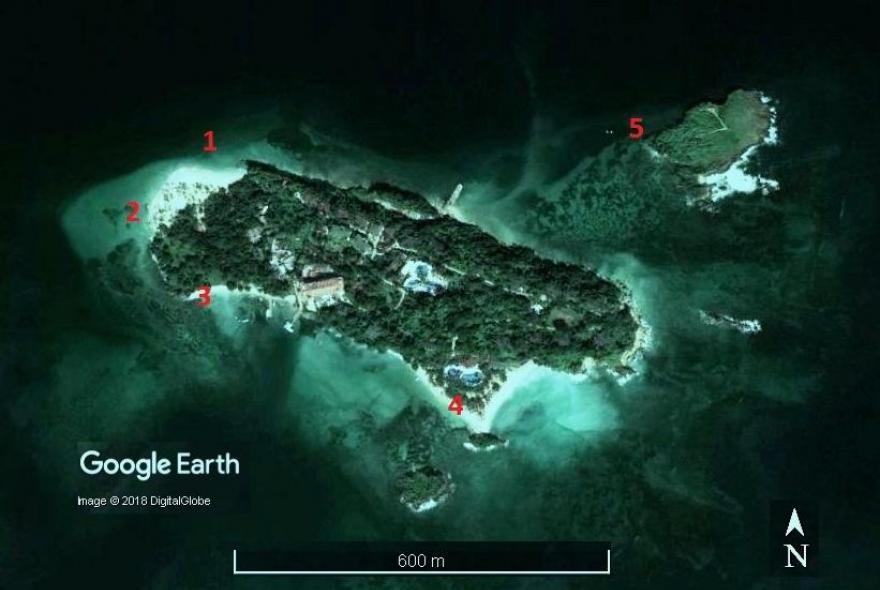
Several safe entry points exist but in all cases the wave conditions will need to be reviewed. Entry points are marked on the map, numbered 1 to 5, with the latter only accessible by boat.
Site 1 is off the public beach on the western end of the island. The sand slopes very gently here, onto a mixed rocky, coral debris, sand and seagrass area. It is subject to some tidal current effects, so try not to allow yourself to drift too far to the east (right facing the sea). The whole of the shore can be snorkelled over from site 1 to site 2, but much of this area is sand with patches of seagrass.
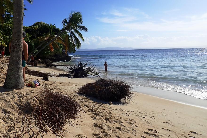
The entry point for site 2 is also off the public beach on the south western corner of the island. The entry is straight off the beach, which slopes gently over most of this area. Avoid entering off the more rocky locations further to the south (left facing sea), as occasional waves roll in, made worse by the wake from passing boats.

The habitat at Site 2 comprises sparse cobbles inshore, gradually becoming consolidated rock further offshore. These support a variety of reef related fish species, with small shoals evident.
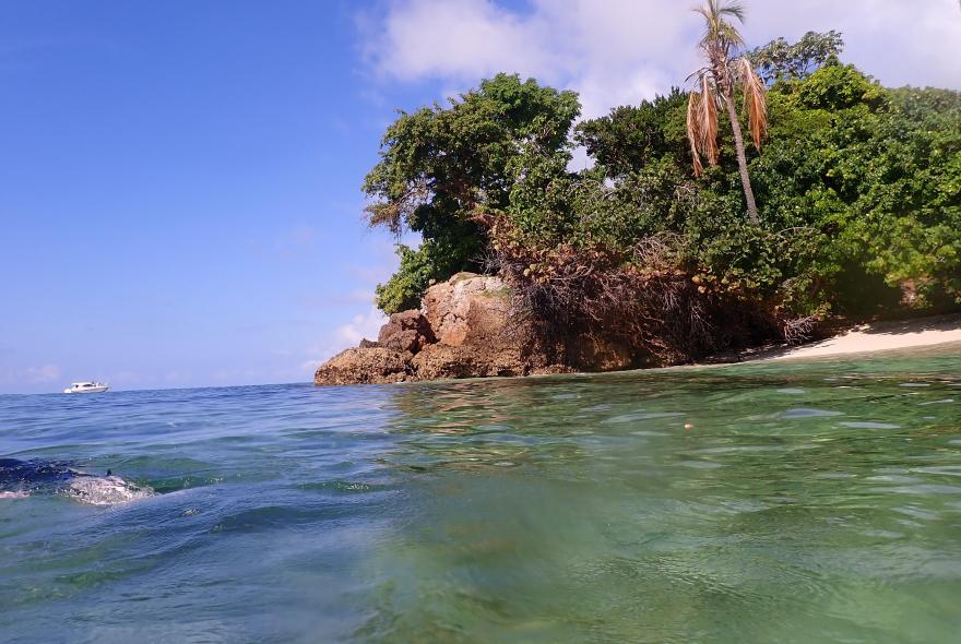
Site 3 is slightly more difficult to enter. It is located at the western end of the beach on the south west corner of the island, in the public area. This beach is periodically subject to a lot of swell, and vessels pass relatively close to shore. Don’t go too close to the rocks on entry and expect to be challenged by the security guards. You need to let them know you will be following the coast round to the main public beach, rather than swimming out to where the vessels operate.
The seabed between entry points 2 and 3 ranges from flat rock to open sand and seagrass areas, with occasional rock gullies closer in shore. Some unusual seagrass seams exist within the rock. The best gullies are at the western end of the area, just before arriving at entry point 2.
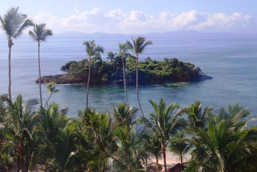
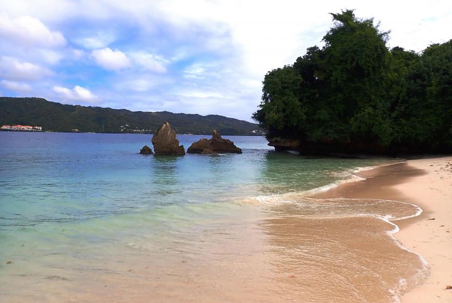
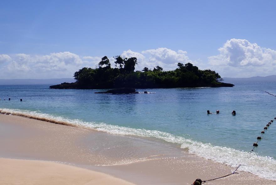
Site 4. Probably the most popular snorkel point is between the small island, slightly off shore, and the main beach in the resort. The small island is viewed here from the top of the lift.
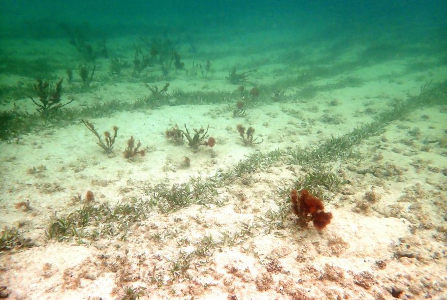
The beach at entry point 4 slopes gently but the area is periodically subject to swell, as well as small vessels (in-advisedly) passing between the island and the roped off swimming area. The seabed is comprised of sands, dense seagrass, with an outcrop of rocks in the centre of the bay. The rock outcrop is surrounded by mixed sand, cobbles and echinoderm bored rock with some coral.
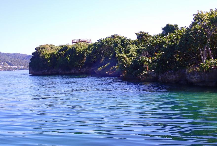
Site 5. The final location included here is only accessible by boat, which will take you first to an offshore wreck, with plenty of shoaling species, then on to site 5 which is along the sheltered edge of the nature reserve on Cayo Farola. Several interesting seafans and corals here, although silt levels are quite high.
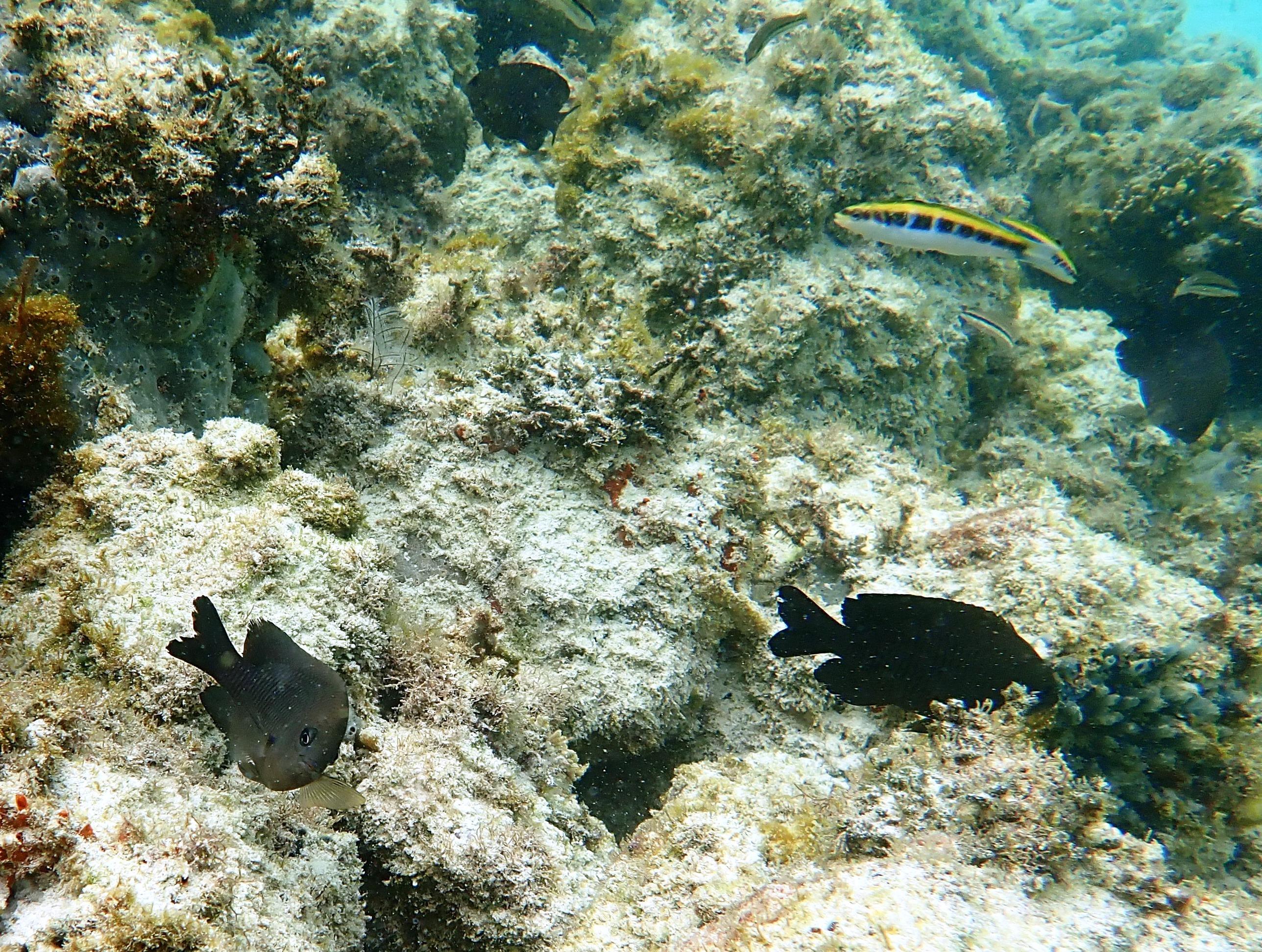
In the foreground a couple of Dusky Damselfish. Pomacentridae. Stegastes ?adustus. Frequently with tatty fins due to territorial competition. Background right Initial phase Bluehead. Labridae. Thalassoma bifasciatum.
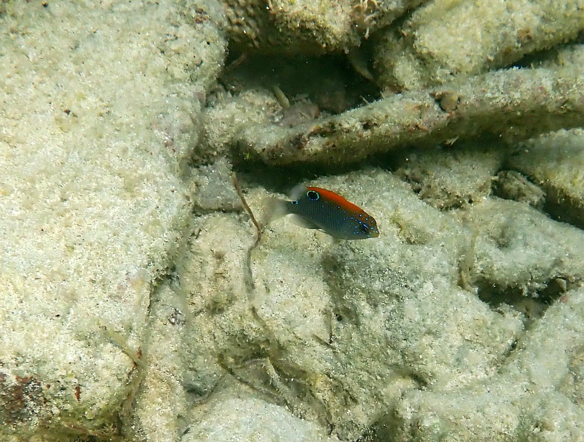
Juvenile Dusky Damselfish. Pomacentridae. Stegastes diencaeus. Noted over coral debris in area 4.
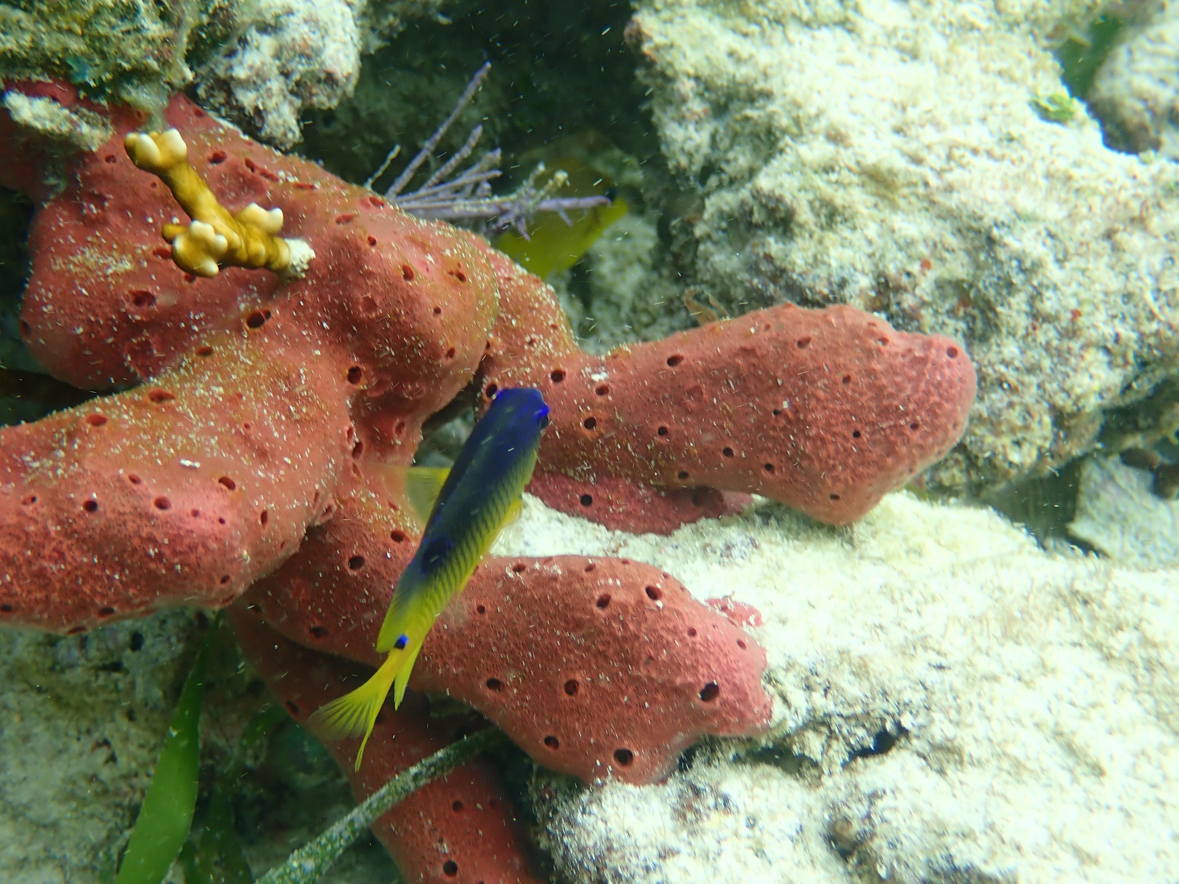
Not ideal angle but distinctive colour and dots, suggest Cocoa Damselfish (older juvenile). Pomacentridae. Stegastes variabilis. Noted in area 2.
Probably Bucktooth Parrotfish initial phase. Scaridae. Sparisoma radians. Noted in gullies between areas 2 and 3.
Possibly an Emerald Parrotfish. Scaridae. Nicholsina usta. Noted amongst mixed seagrass and cobbles in area 4.
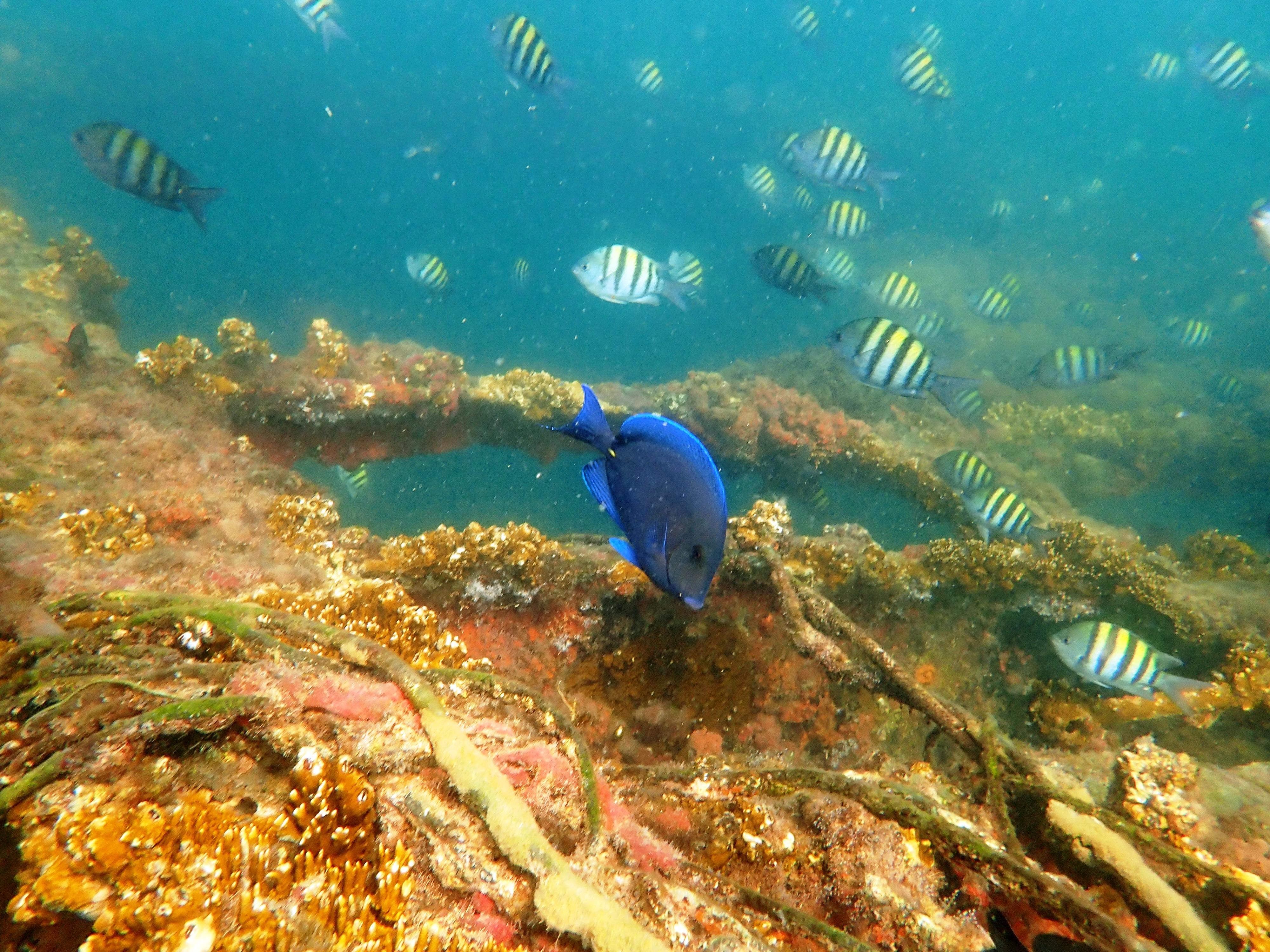
Adult Blue Tang. Acanthuridae. Acanthurus coerleus, amongst a shoal of Sergeant Majors. Pomacentridae. Abudefduf saxatilis. Observed off the wreck site.
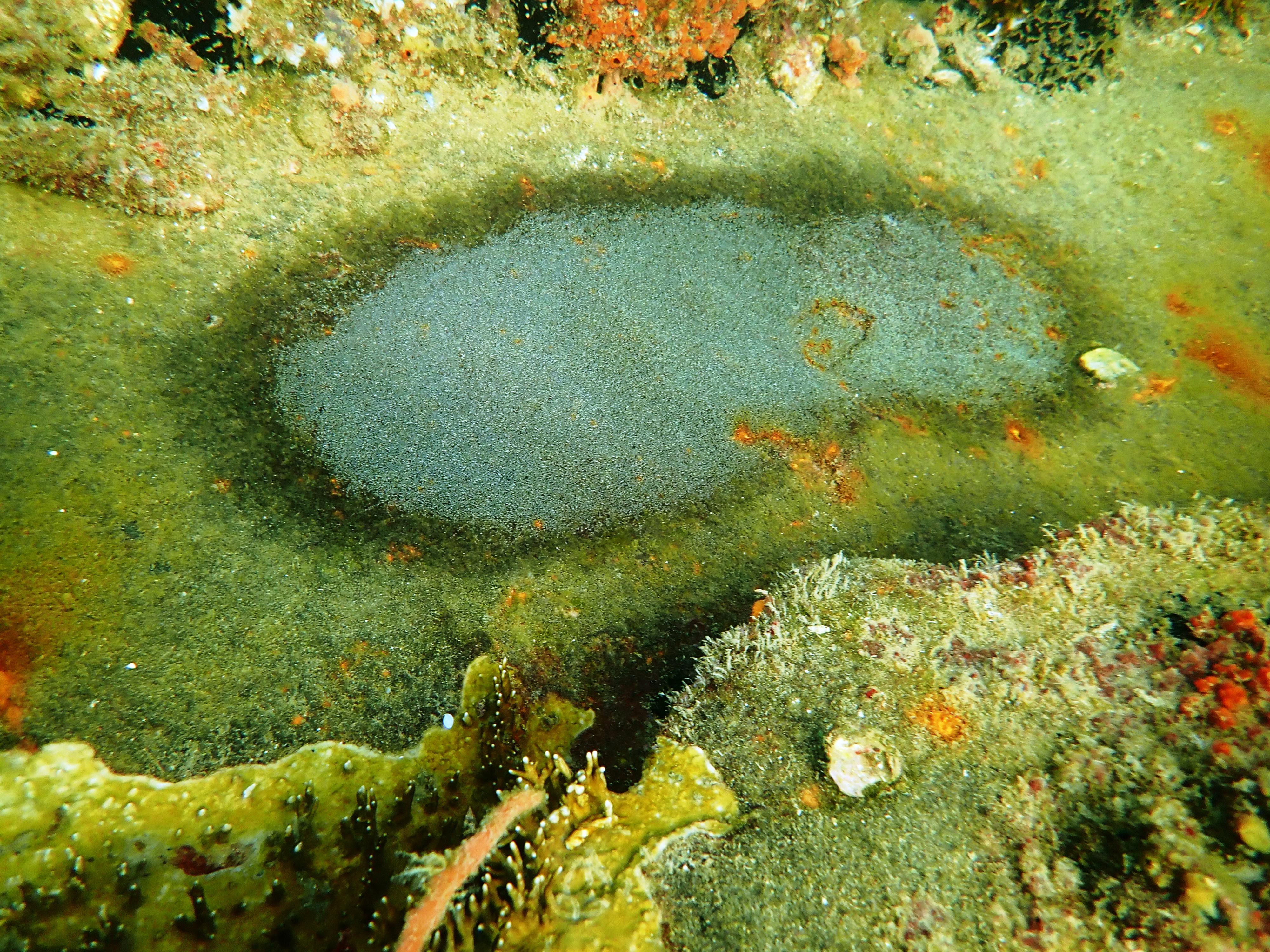
Egg patch noted on the metal plates of the wreck. Probably laid by Sergeant Major.
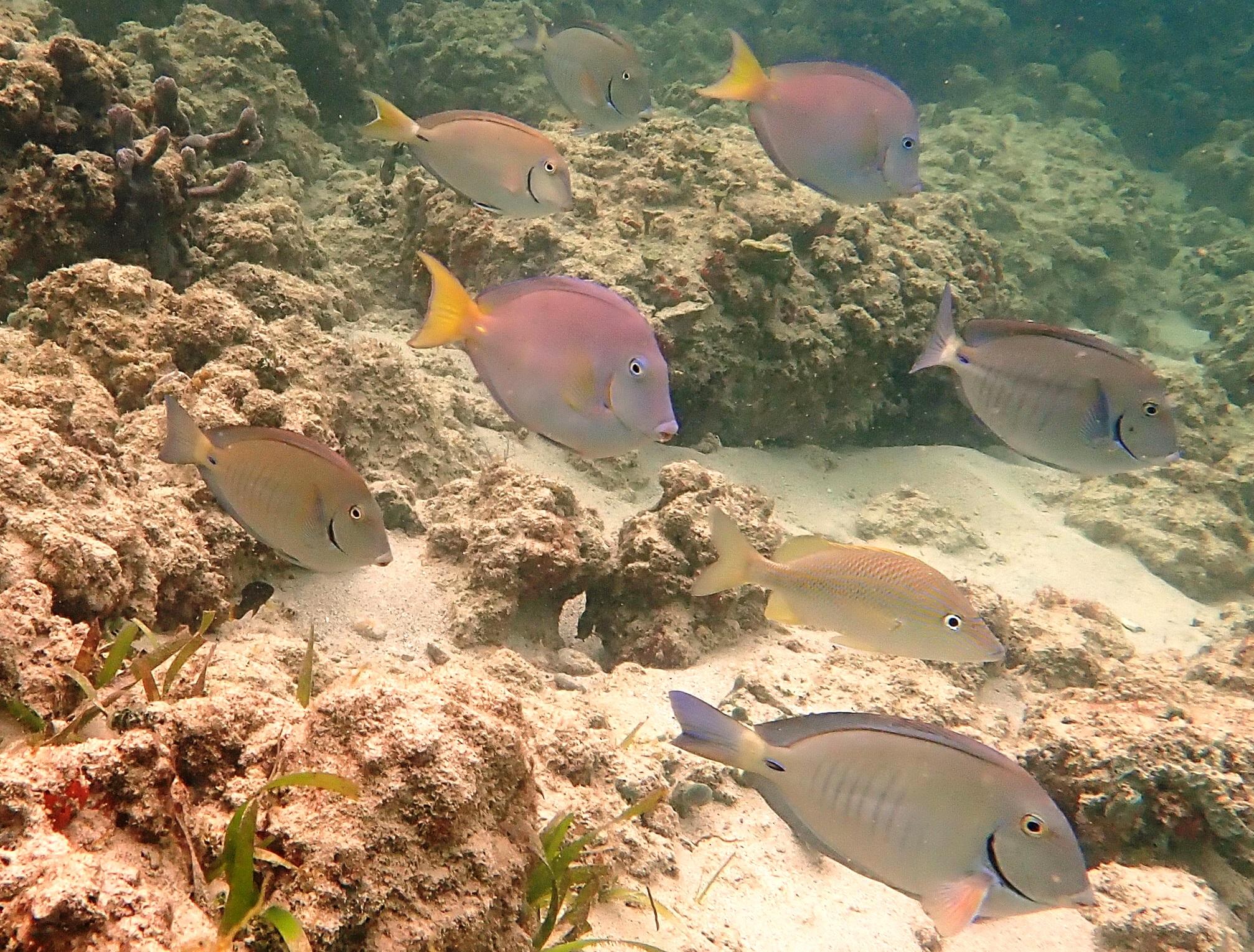
Three species. Vertical striped are the Doctorfish. Acanthuridae. Acanthurus chirurgus. Yellow tailed is an intermediate phase Blue Tang. Acanthuridae. Acanthurus coeruleus, Third is a White Grunt. Haemulidae. Haemulon plumieri. All area 2.
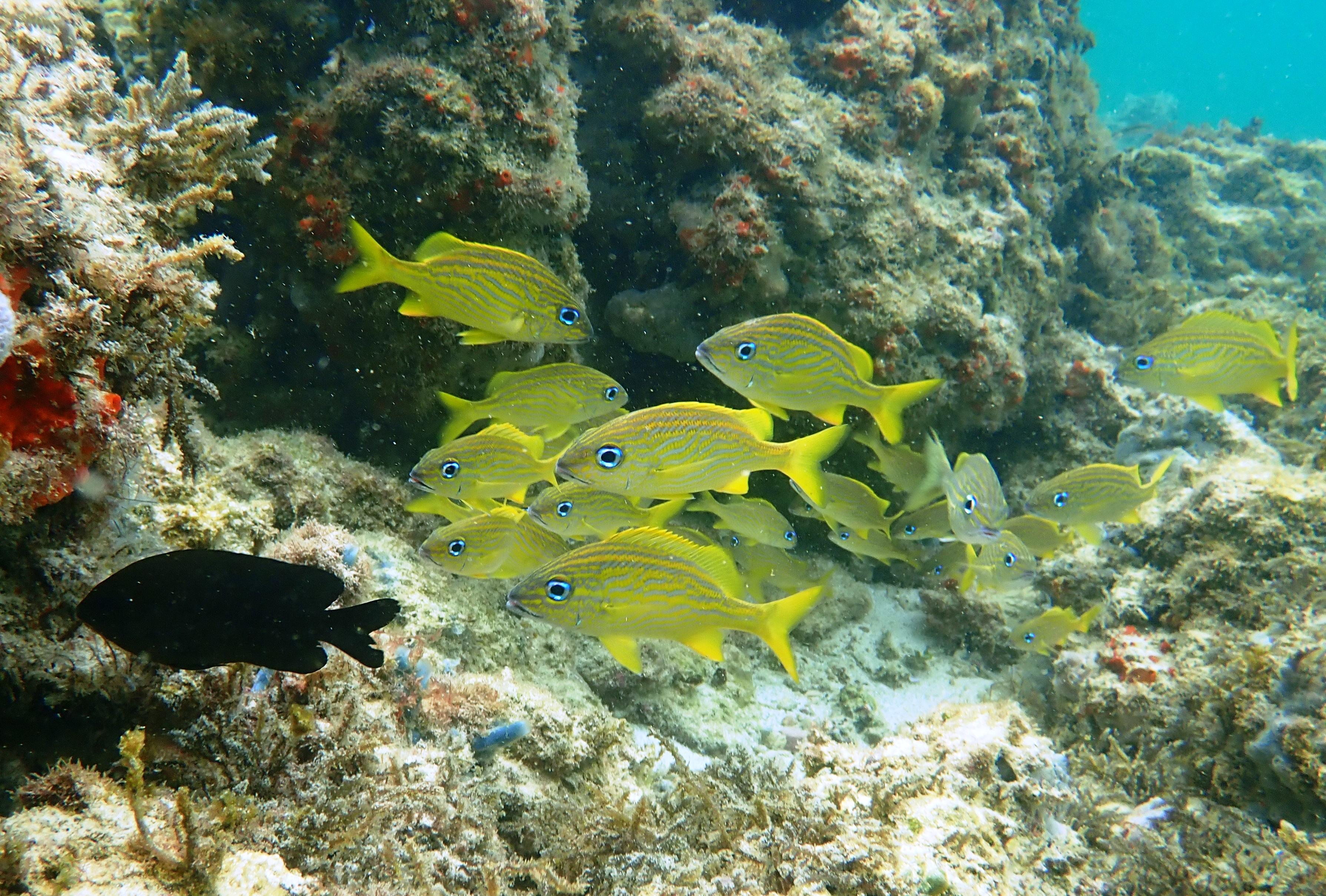
Small shoal of French Grunts. Haemulidae. Haemulon flavolineatum. Noted off area 2.
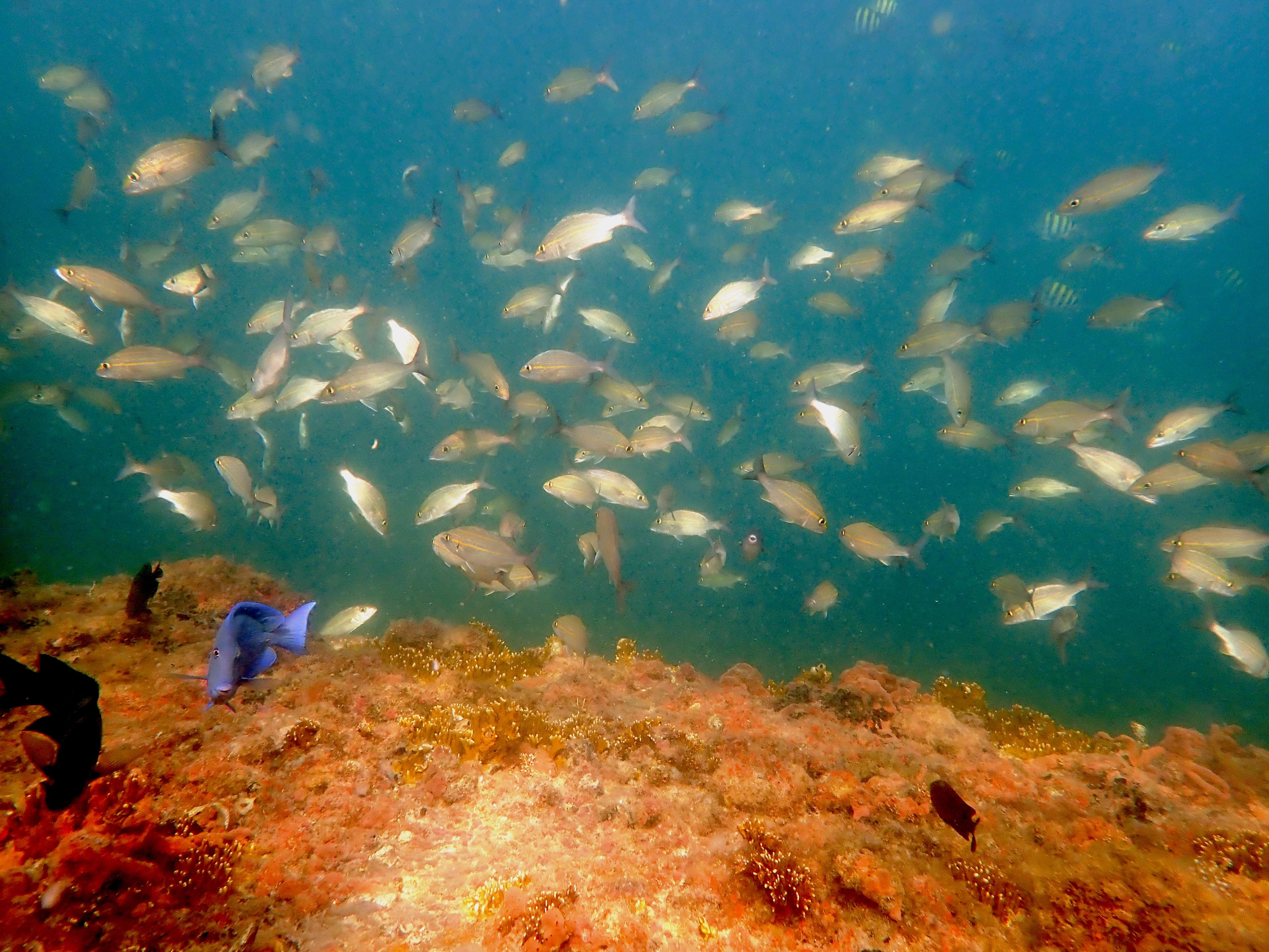
Shoal of Tomtate. Heamulidae. Haemulon aurolineatum. Observed off the wreck.
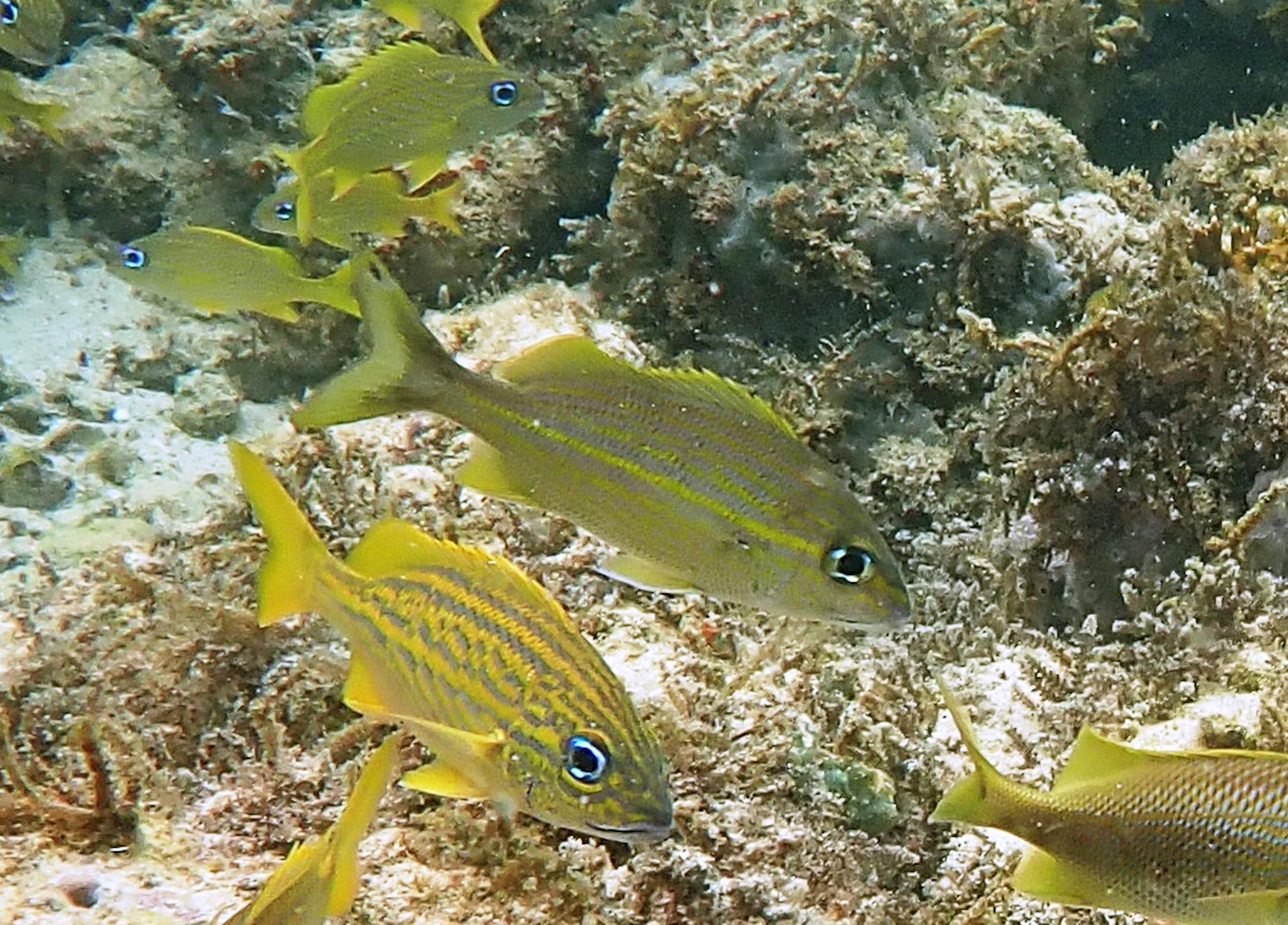
Central species, probably a Striped Grunt. Haemulidae. Haemulon ?striatum. Noted in area 2 mixed in with French Grunts
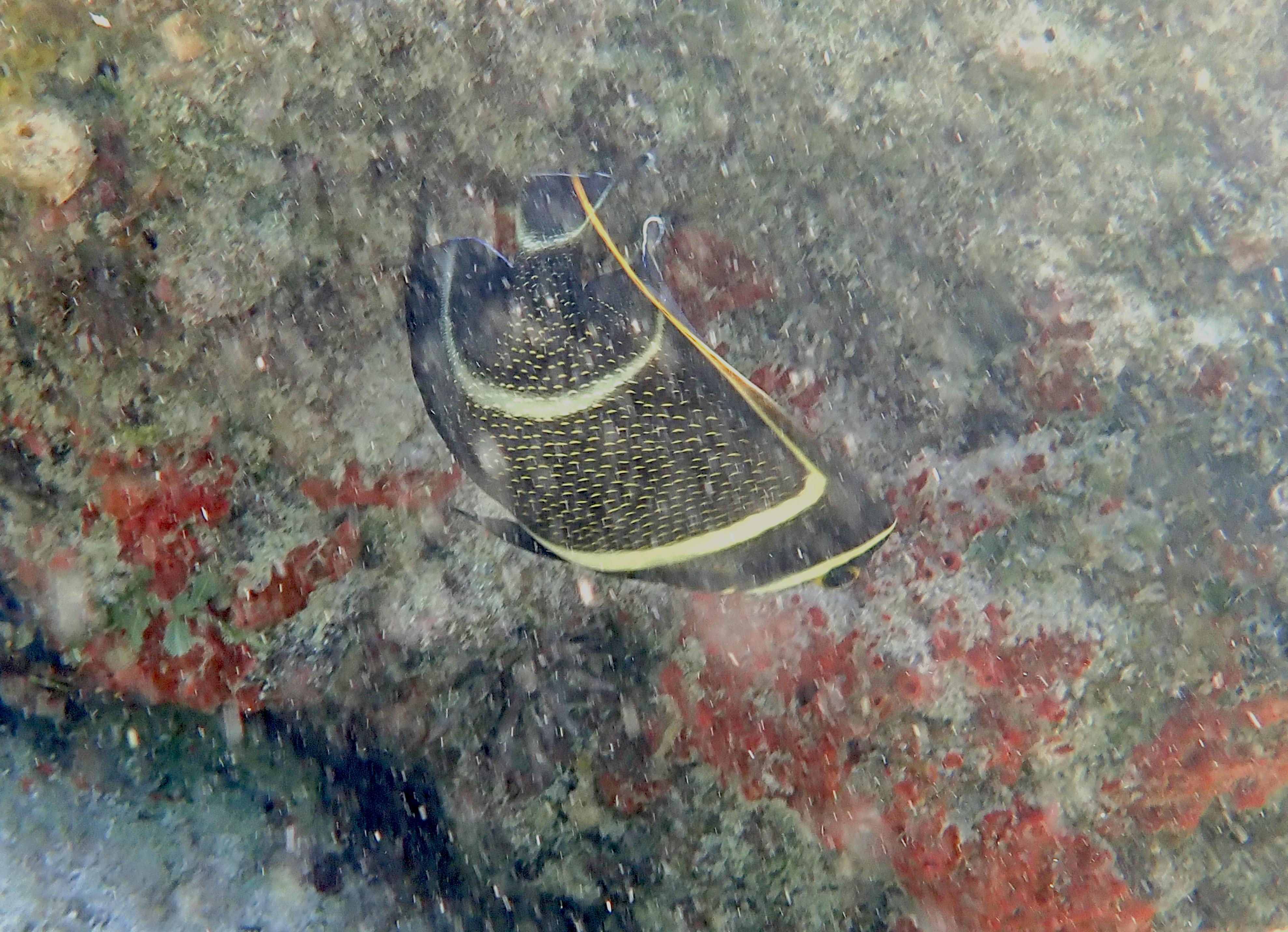
Uncooperative but distinctive, intermediate phase French Angelfish. Pomacanthidae. Pomacanthus paru. Noted amongst boulders in area 3.
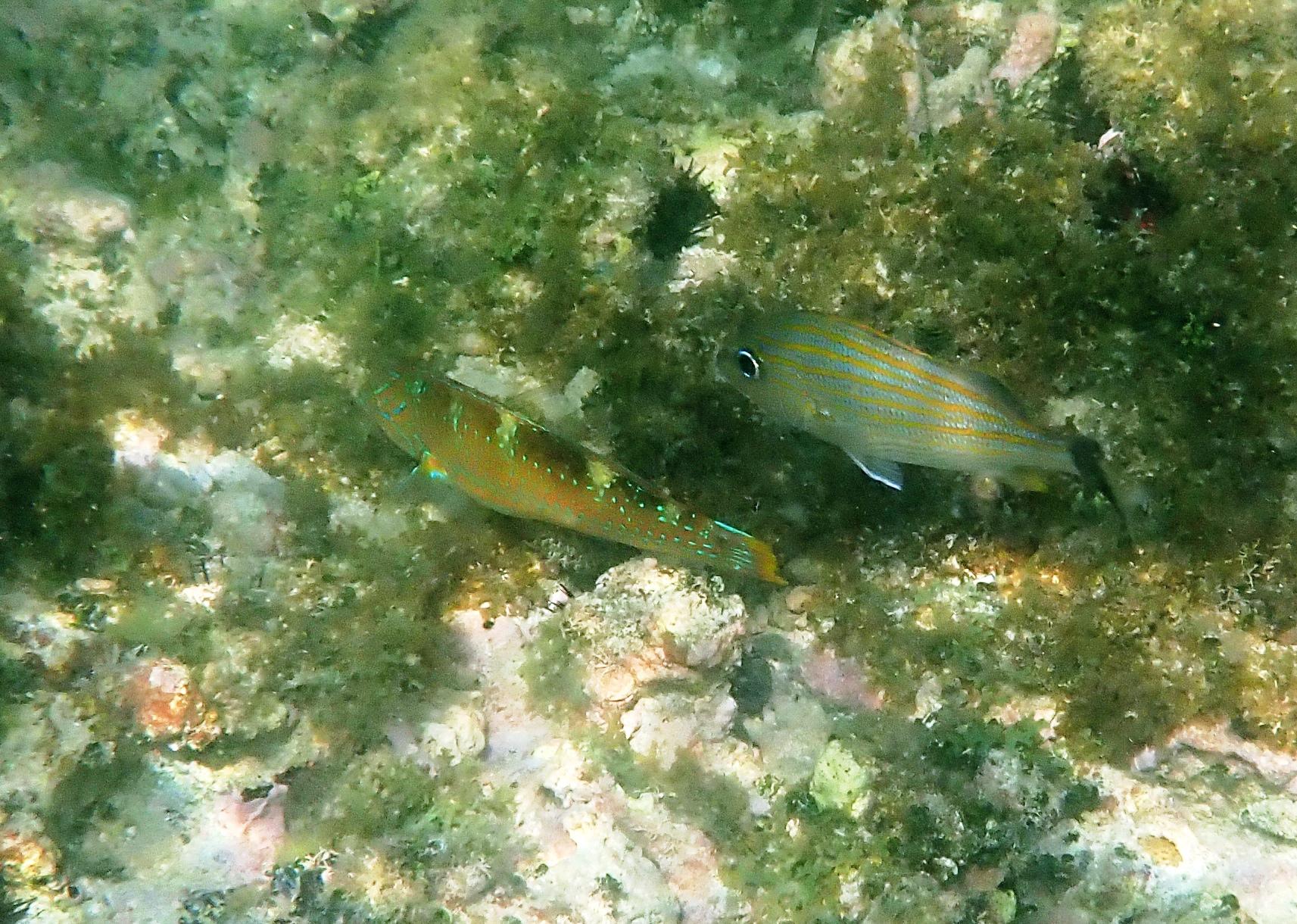
Two species. To the left an initial phase Pudding Wife. Labridae. Halichoeres radiates. To the right a Striped Grunt. Heamulidae. Haemulon striatum. Both noted in area 4, around the central rock.
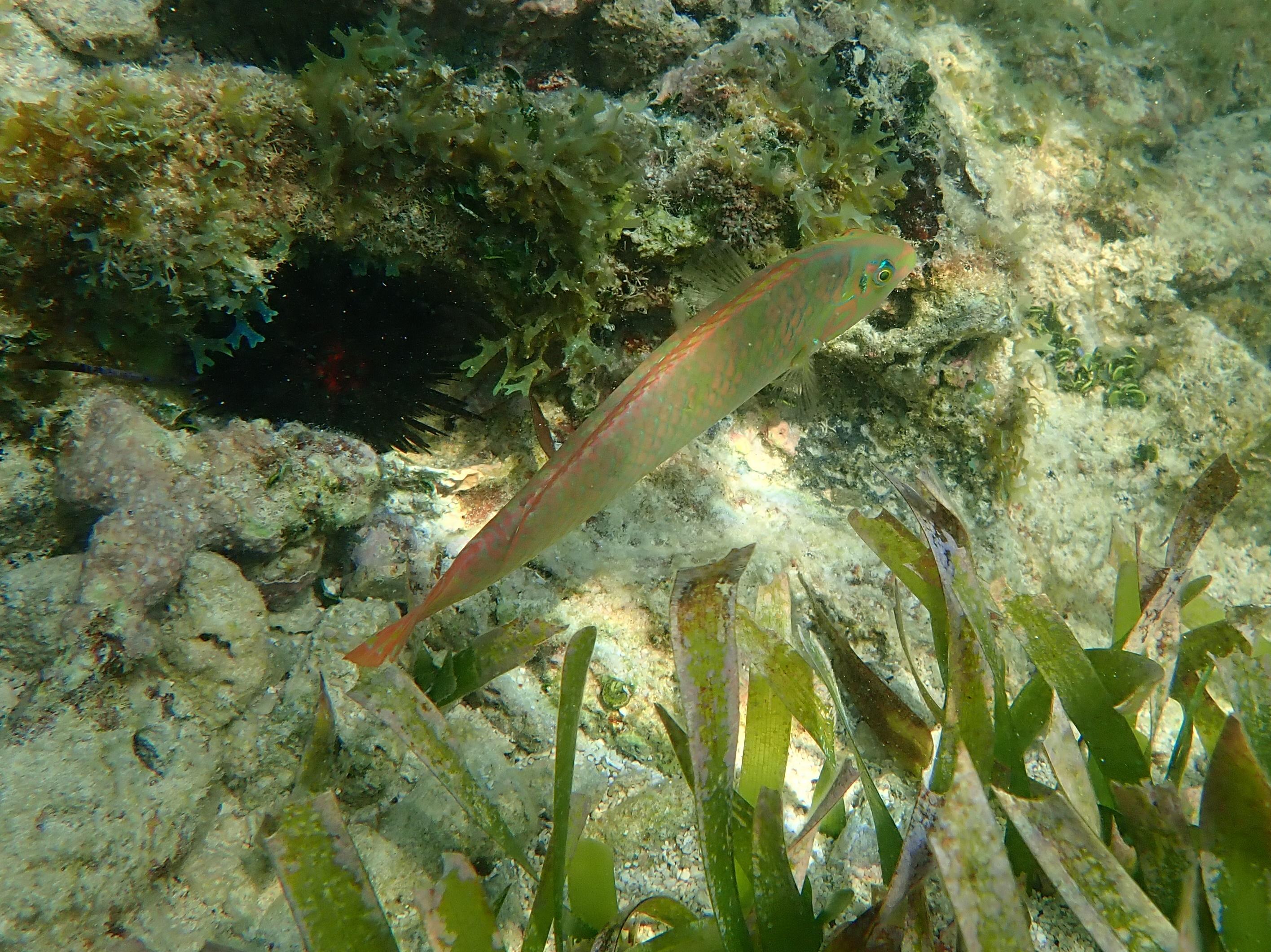
Blackear Wrasse. Labridae. Halichoeres poeyi. Noted in the vicinity of the central rock of area 4.
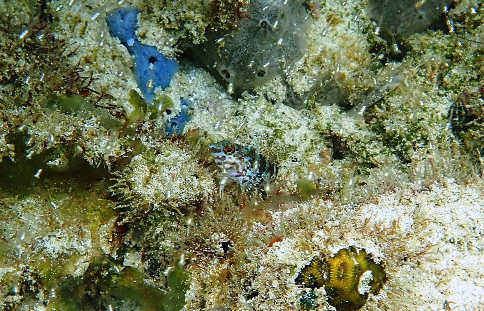
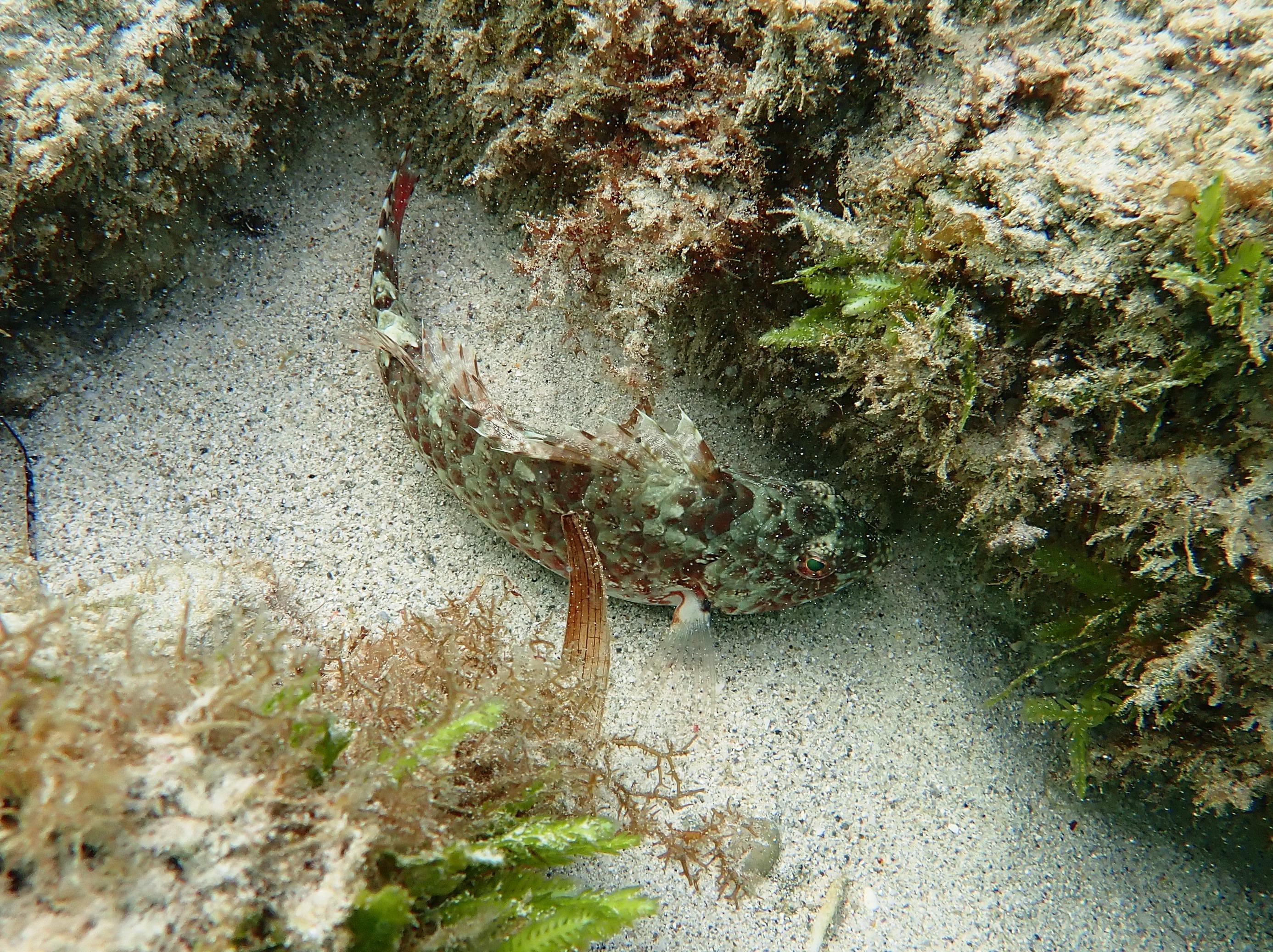
Probably a Goldline Blenny. Labrisomidae. Malacoctenus ?aurolineatus. Very small species hidden in stones and cobbles of area 4.
Probably a Saddled Blenny. Labrisomidae. Malacoctenus ?triangulatus.
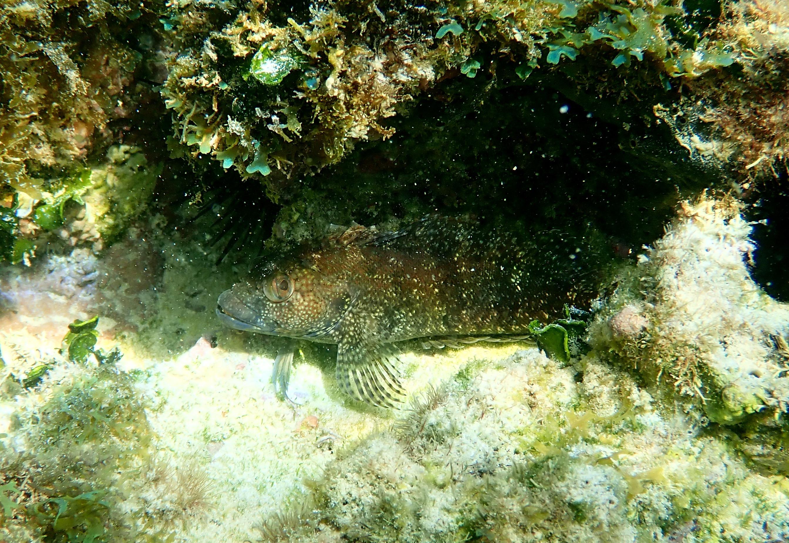
Hairy Blenny (female). Labrisomidae. Labrisomus nuchipinnis. Found hiding in crevices and under overhangs between areas 2 and 3.
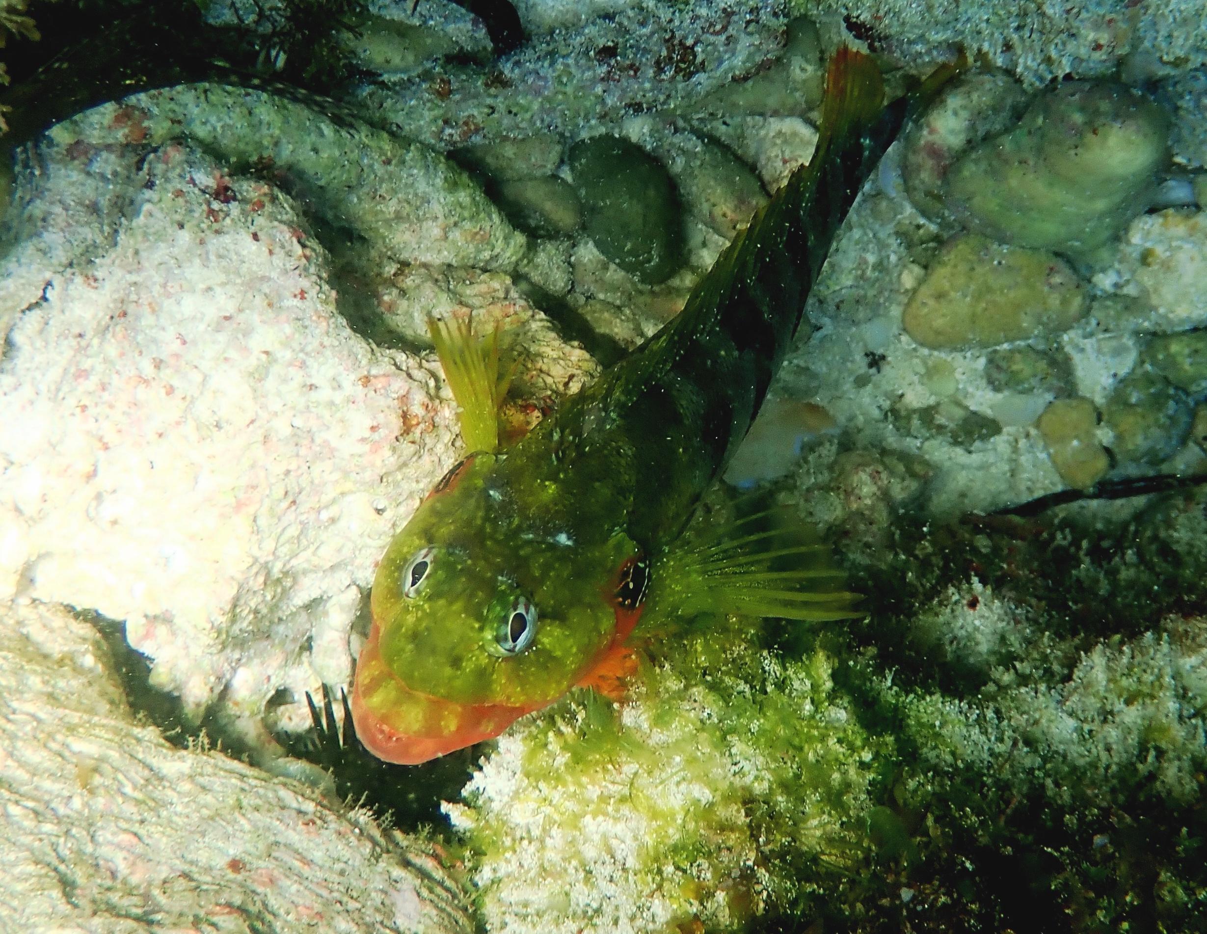
Hairy Blenny (male). Labrisomidae. Labrisomus nuchipinnis. Found hiding in crevices and under overhangs between arras 2 and 3.
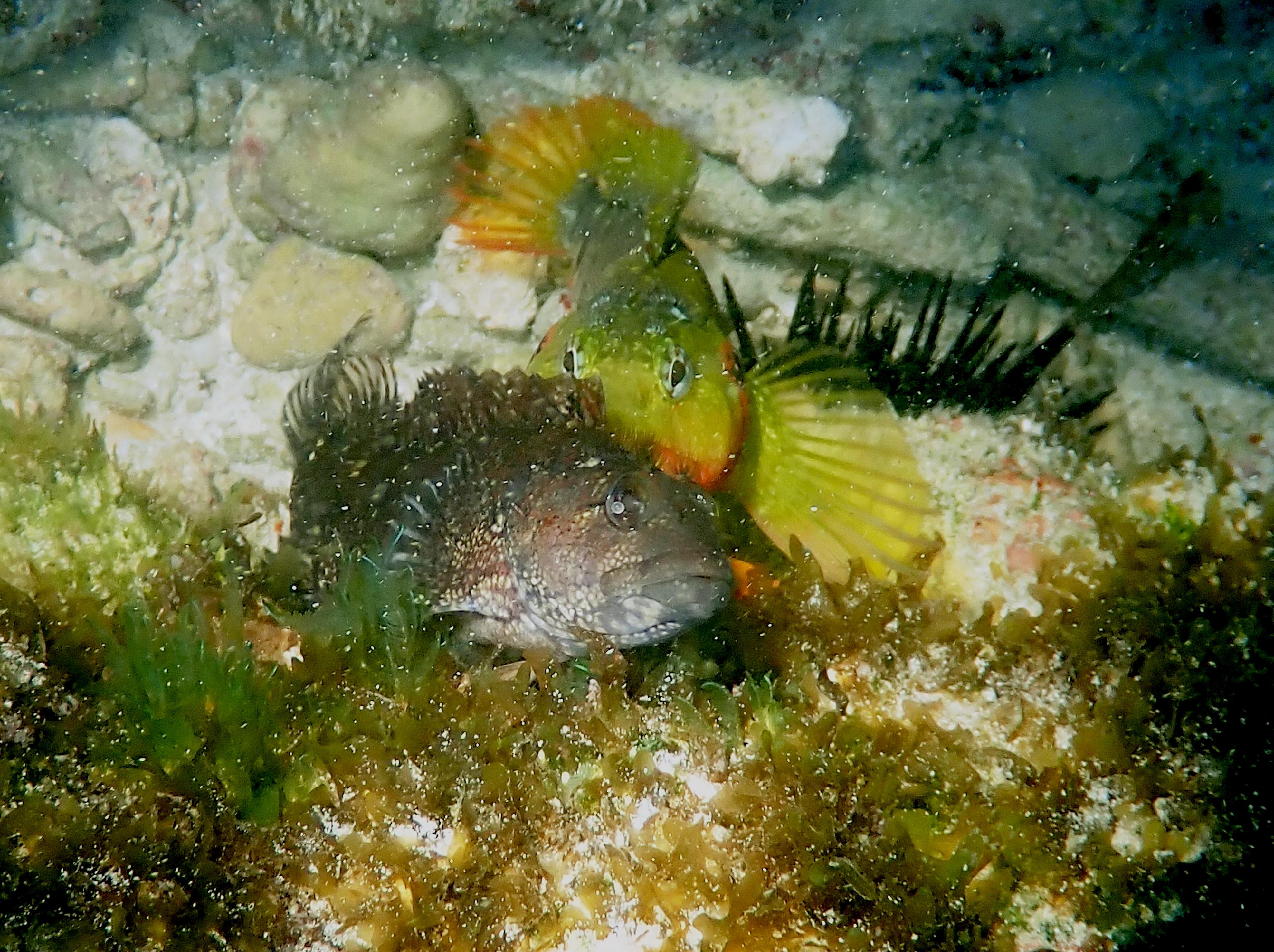
Male and Female Hairy Blenny together.
Marbled Puffer. Tetraodontidae. Sphoeroides testudineus. Noted over seagrass and mixed rock, between area 2 and 3.
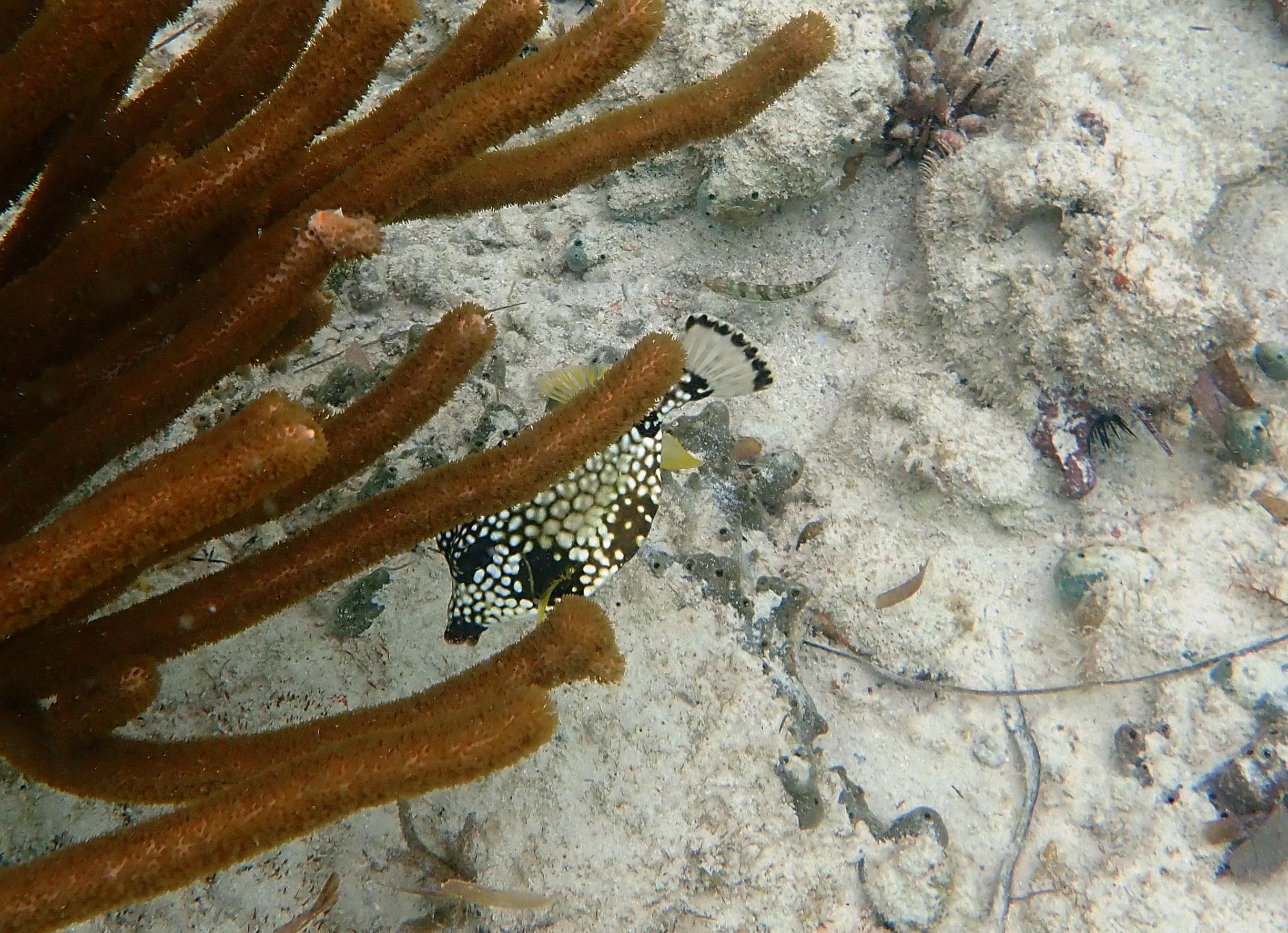
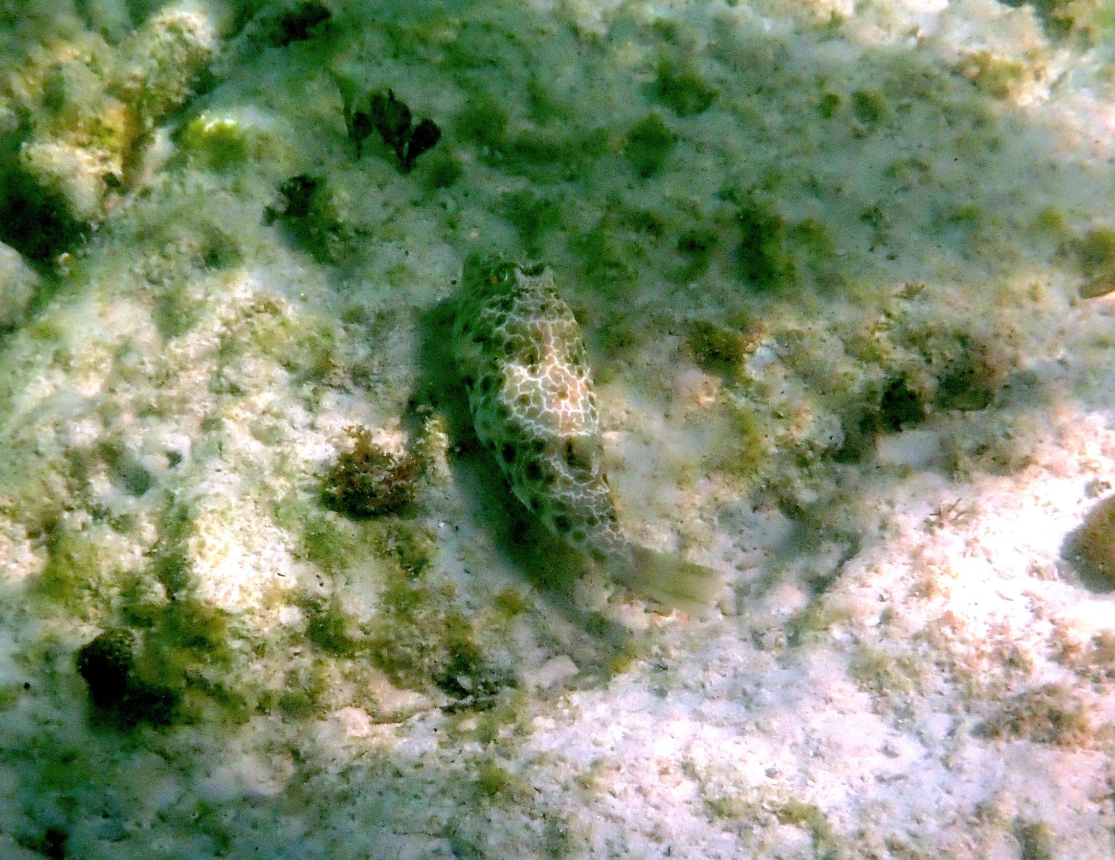
Distinctive shape (despite being partially hidden) of the Smooth Trunkfish. Ostraciidae. Lactophrys triqueter. Noted in areas 1 and 2.
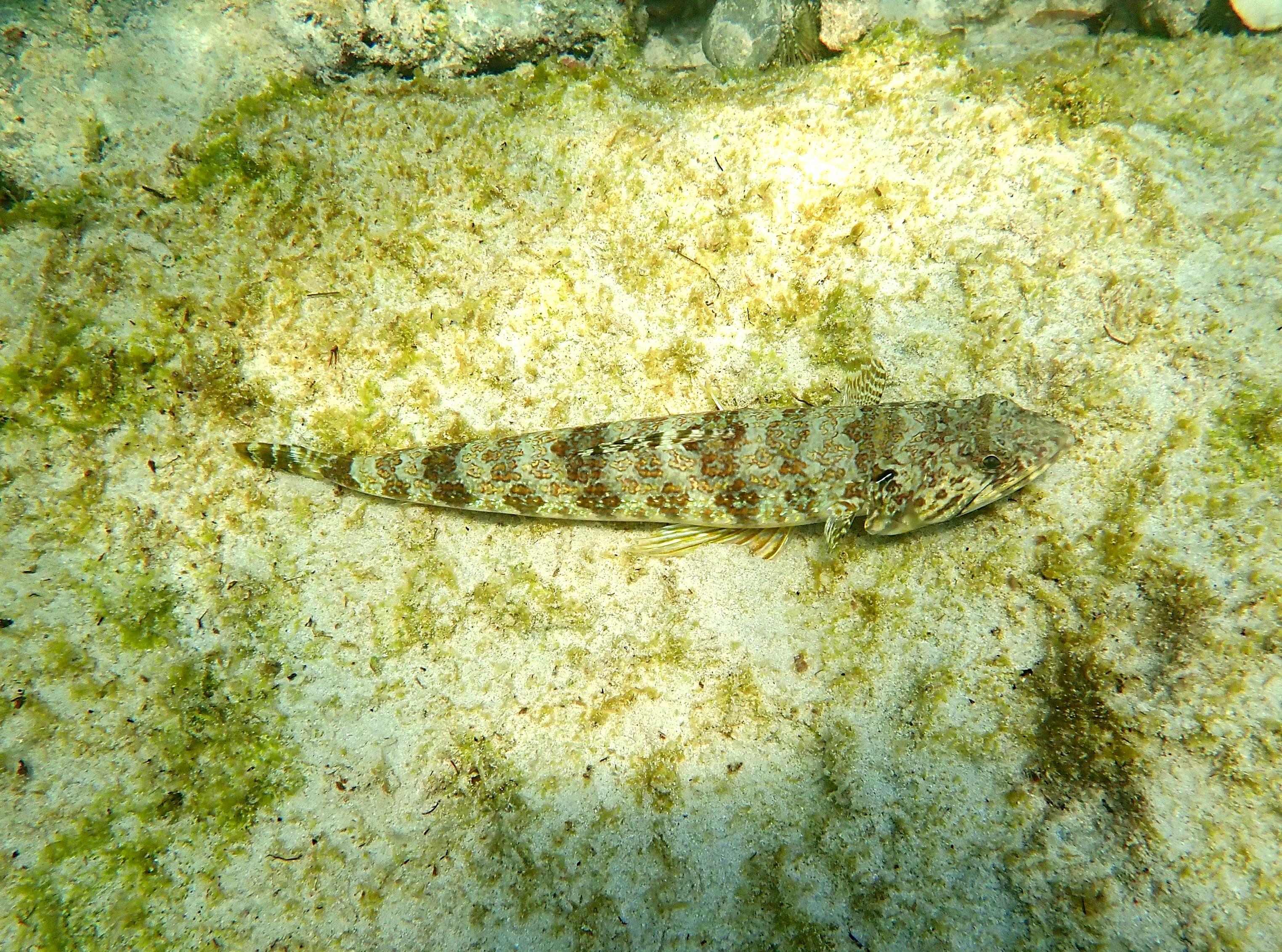
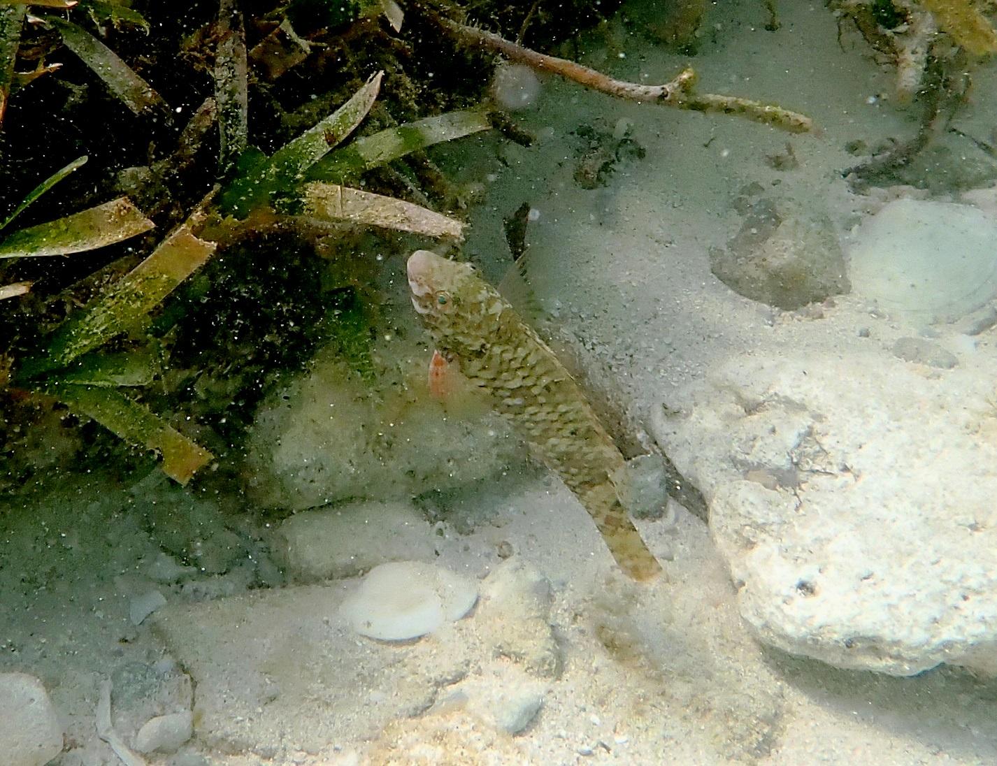
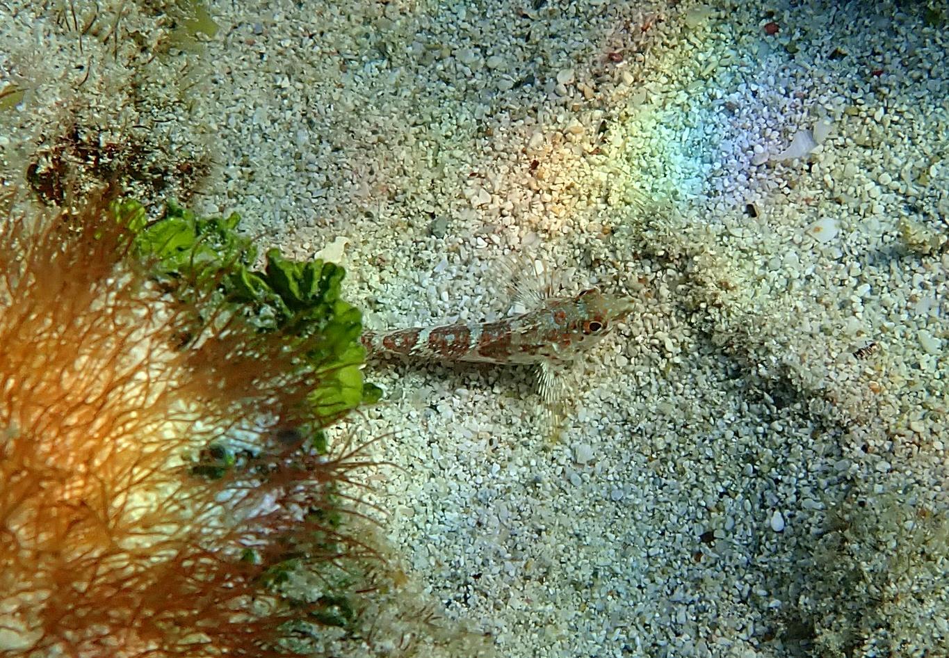
Sand Diver. Synodontidae. Synodus intermedius. Medium sized bottom fish found in areas 1, 2 and 4.
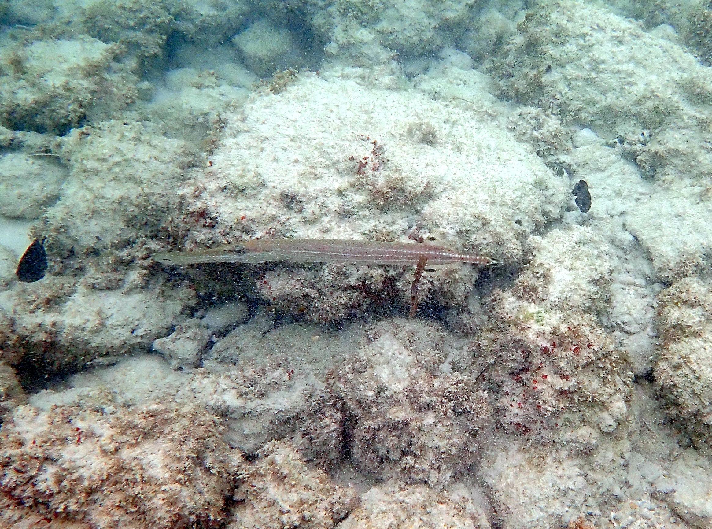
A little murky but shape distinctive of the Trumpetfish. Aulostomidae. Aulostomus maculatus. Noted over area 2.
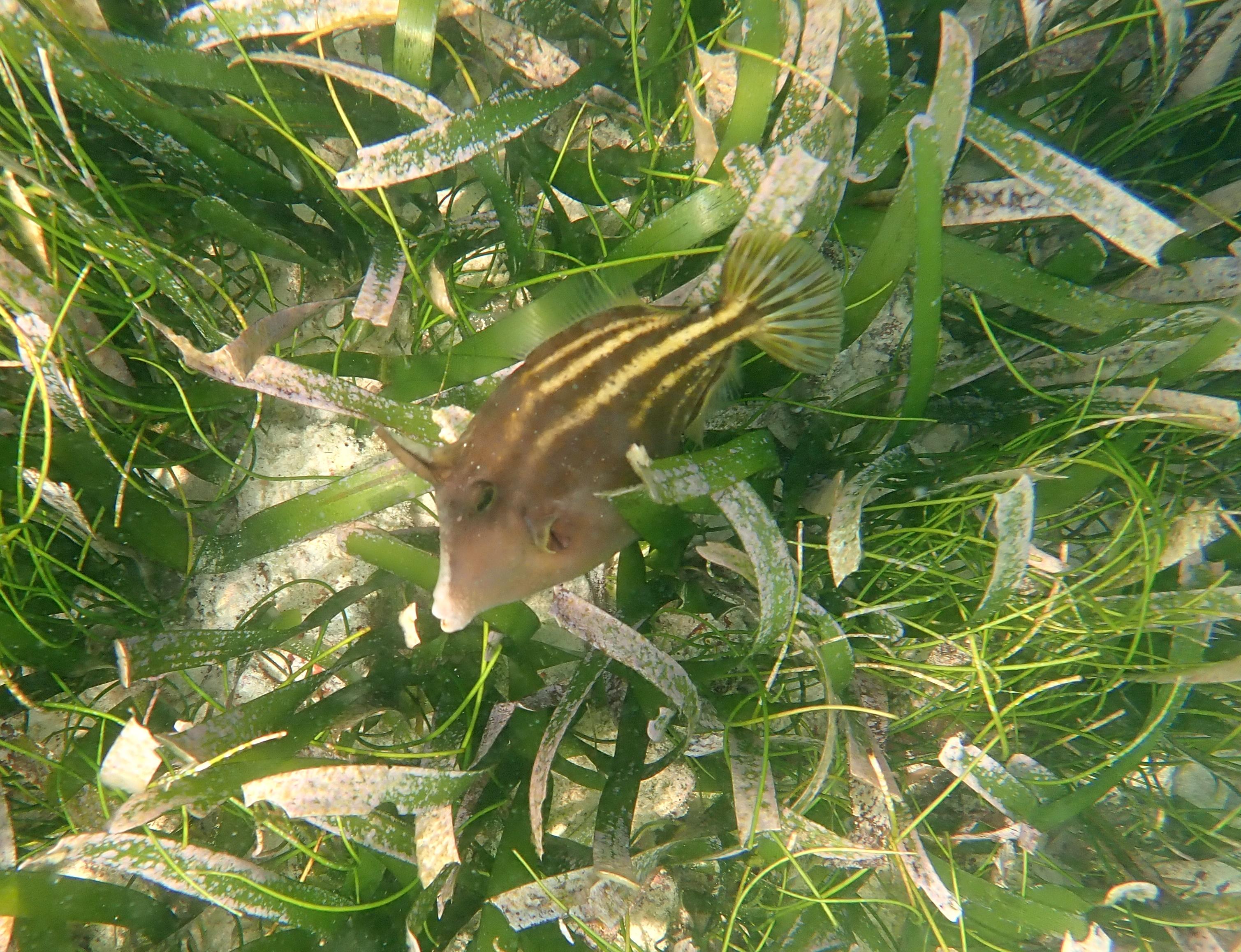
Orangespotted Filefish. Monacanthidae. Cantherhines pullus. Noted over the seagrass beds in area 4.
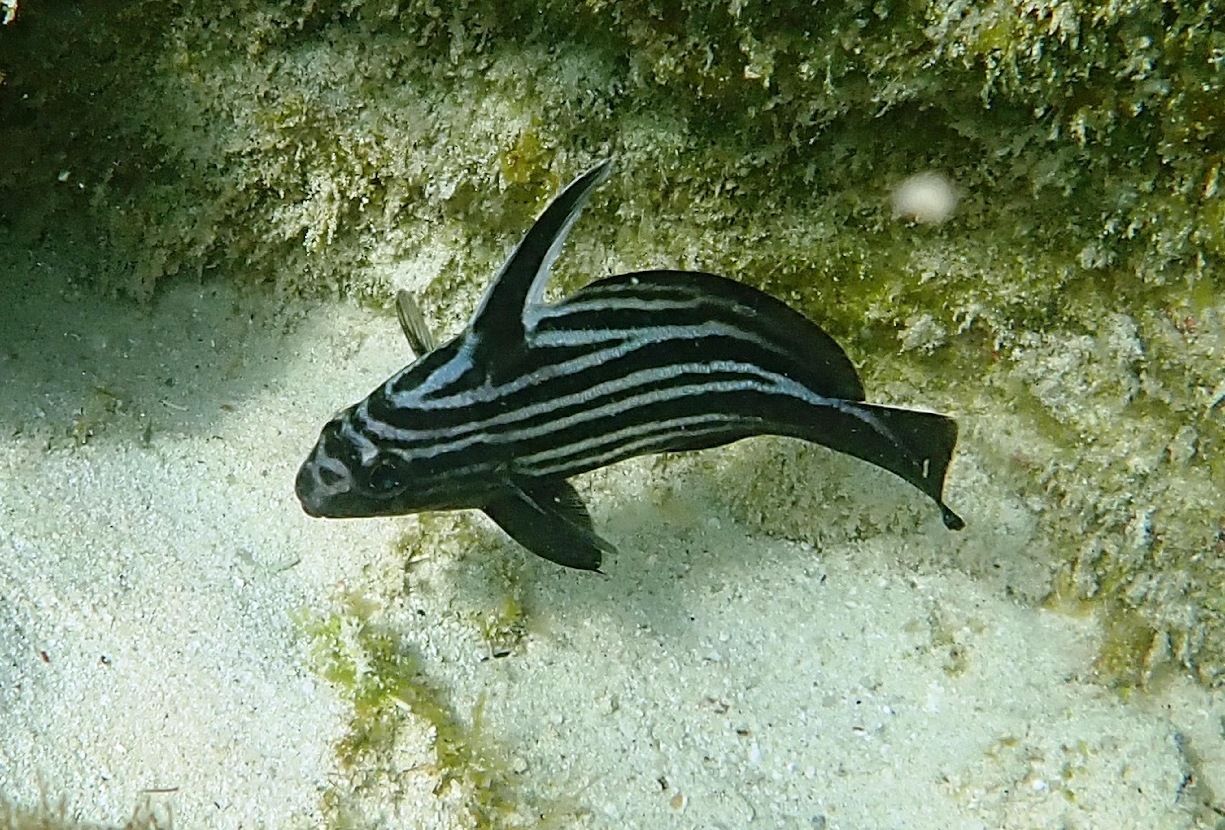
Highhat. Sciaenidae. Pareques acuminatus. Noted under overhangs in areas 3 and 4.
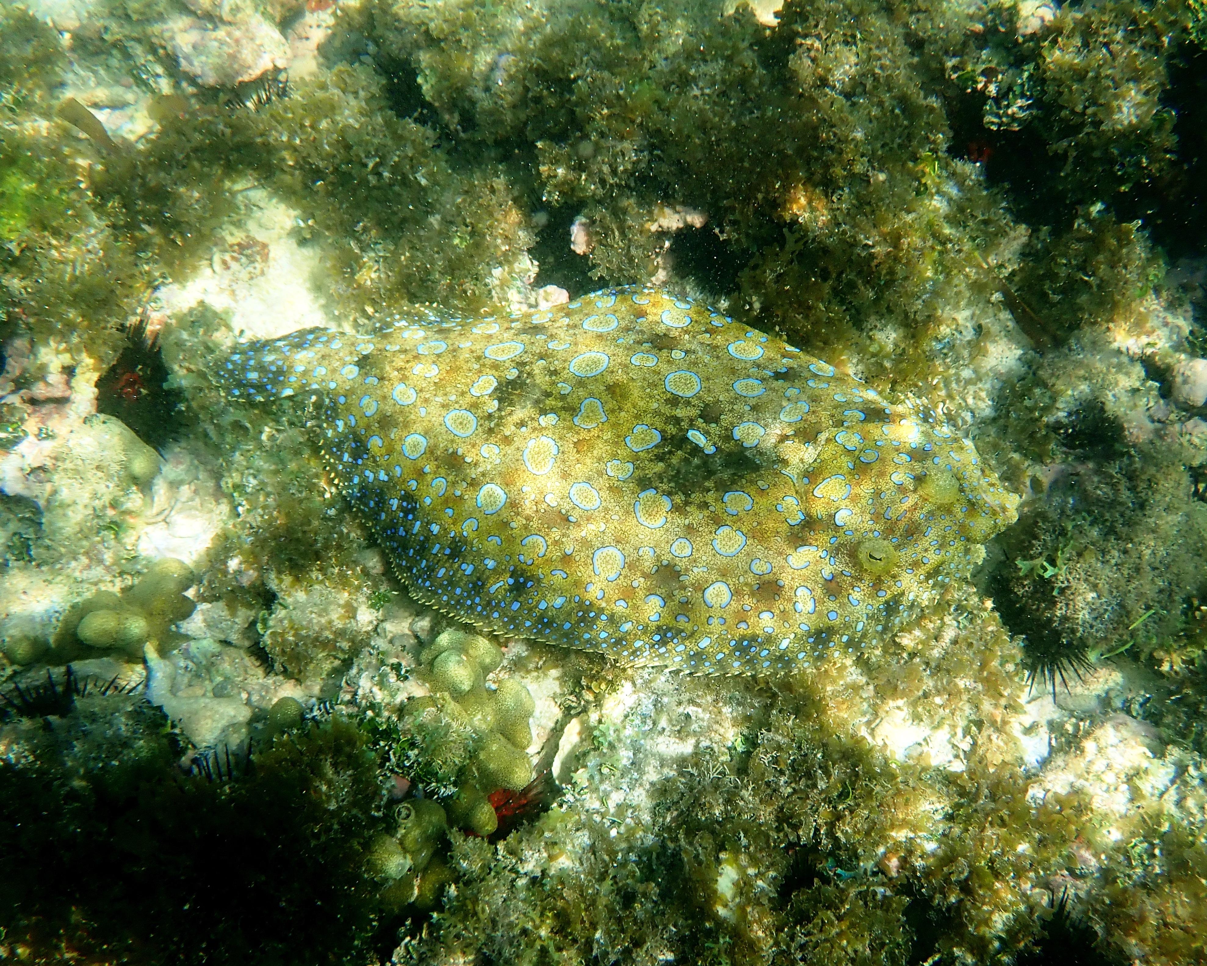
A well camouflaged Peacock Flounder. Bothidae. Bothus lunatus. Noted over the rocks in in area 4.
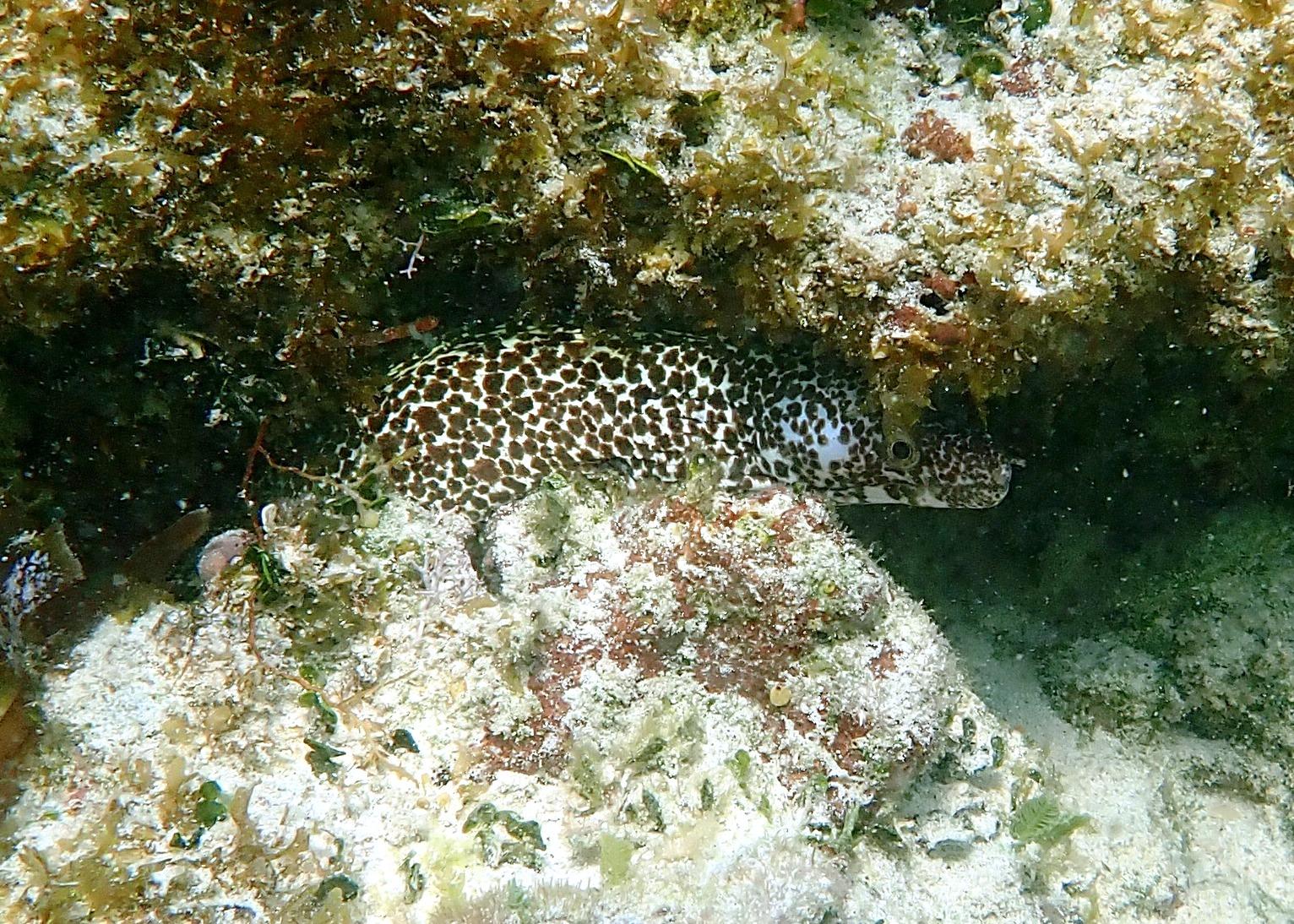
Spotted Moray. Muraenidea. Gymnothorax moringa. Noted hiding under boulders between areas 3 and 2.
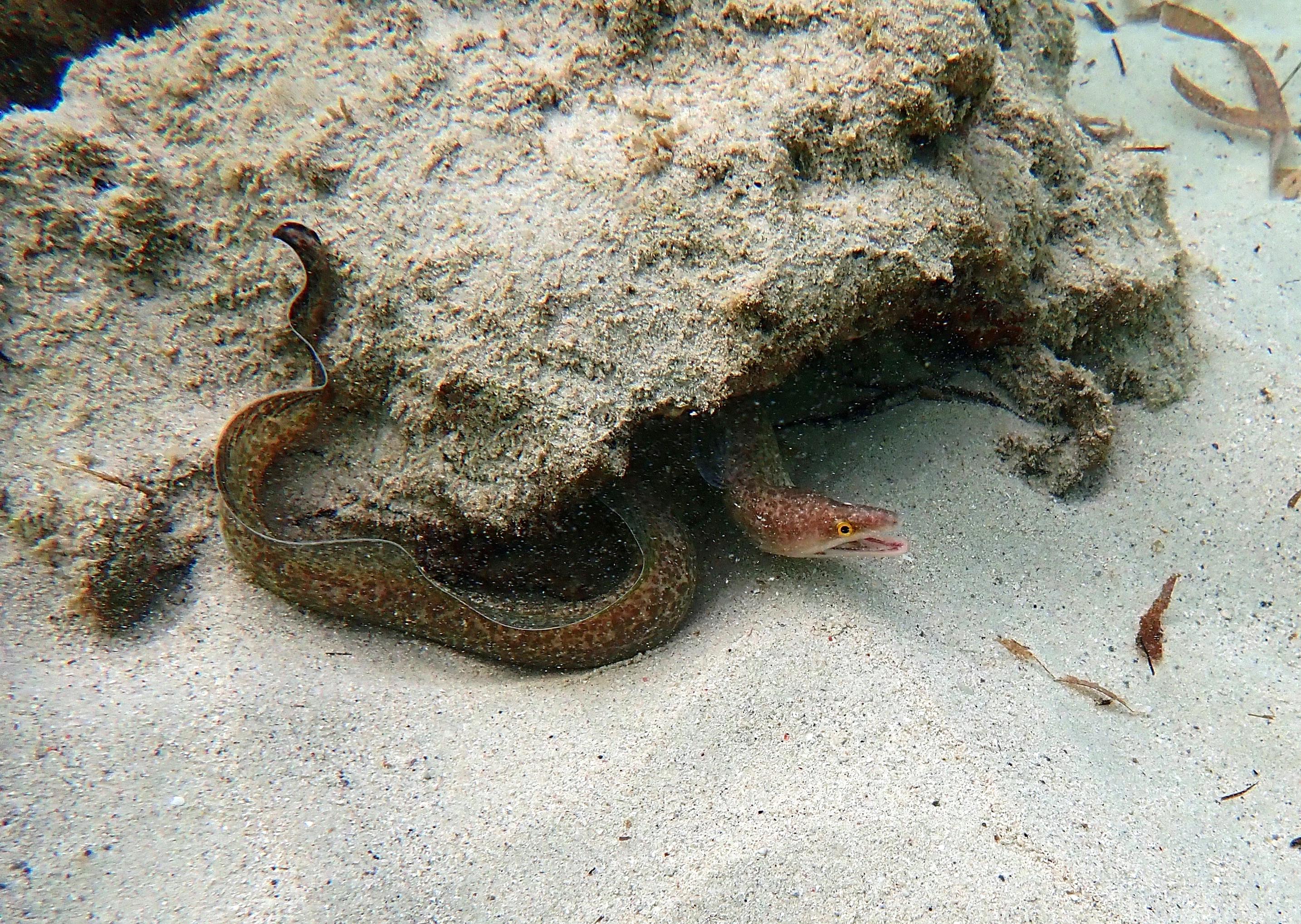
Probably Purple Mouth Moray. Murenidae. Gymnothorax ?vicinus. Noted in the interface between sand and rock of area 2.